A GIS approach to determine locations for rainwater harvesting in Haiyuan, Ningxia, China
Mika Xu, MLWS 2023
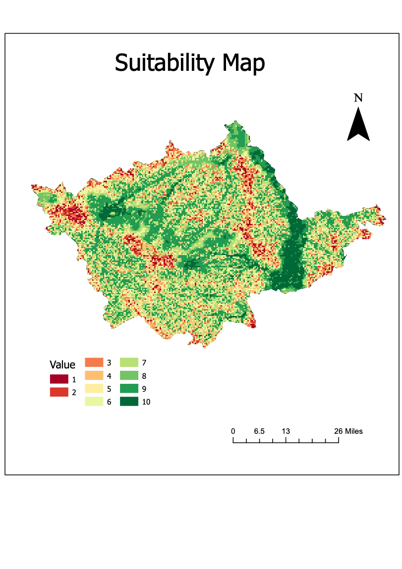
As water scarcity continues to be a critical issue in less developed countries, rainwater harvesting offers a promising solution to augment water resources sustainably. The ridge and furrow method is a highly suitable rainwater harvesting technique for China due to its compatibility with the country’s topography, climate, and agricultural practices. By integrating geospatial data on rainfall, land cover, slope, soil types and drainage network, a GIS suitability model was developed to assess the suitability of different locations for rainwater harvesting systems. Generally, the study area is ideal for ridge and furrow method, with 64% of the area showing high suitability value ( >= 7). This study provides valuable insights for policymakers and urban planners in identifying optimal sites for rainwater harvesting infrastructure, thus supporting water resource management efforts and promoting sustainable water practices in China.