The role of floodplain mapping in managing flood risk in Canada
Yu Bai, MLWS 2022
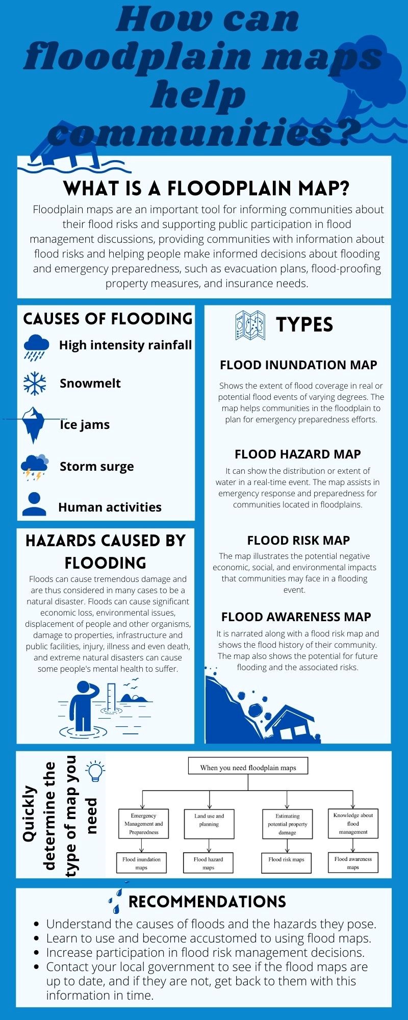
Effective flood risk management measures need to be put in place in order to reduce the damages caused by floods. This paper reviews the floodplain map as a flood management tool; while maps are a widely accepted and credible source of information to support community decision-making on flood management, mapping technologies are rapidly evolving and many flood maps in Canada are significantly out of date. As communities (re)assess their floodplain information and management strategies, this document provides an information resource and review of important questions to consider in floodplain mapping. Why are floodplain maps important? What are the different types of floodplain maps, and what types of data are needed for their development? How do land use change and climate change impact the reliability of floodplain maps? Which types of flood maps are the most appropriate to support decisions around different land management concerns/priorities? In addition, this paper presents useful background information for the public, particularly those who are not familiar with flood management. The goal of this paper is to provide information for general public, communities and policy makers to utilize and develop flood management tools prudently, to ensure greater protection from floods.